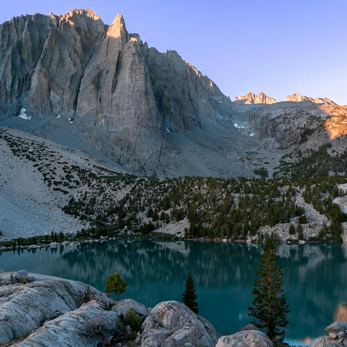
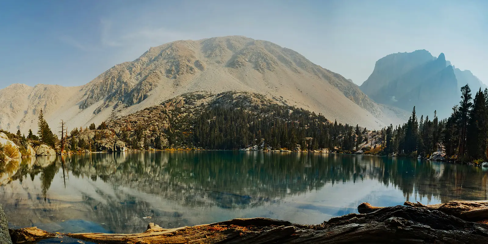
The Big Pine Lakes are officially a group of seven lakes that are hike-in only. They lie in Owens Valley in the John Muir Wilderness in Inyo National Forest, which is in the heart of the Eastern Sierras in California. They are affectionately named First Lake through Seventh Lake in the order that people can hike into them.
Where Are Big Pine Lakes?
Besides the seven Big Pine Lakes, hikers can also visit Black Lake, Summit Lake, and Sam Mack Lake, and the Palisades. Visitors can do the approximately 16-mile out and back trail in one day, but to enjoy the stunning scenery entirely, it is optimal to back country camp. Horseback riding is also popular.
To find the Big Pine Lakes North Fork and South Fork trailheads, hikers have to go to Big Pine, California, at I-395 at the junction of CA Route 168, and the trailhead is outside of Big Pine. Crocker Street in Big Pine turns into Glacier Lodge Road heading west, which leads to the Big Pine Lakes trailhead.
There are several campgrounds before the trailhead, the Big Pine Creek Campground, and an overnight parking lot near the trailhead. The hike to First Lake is about seven miles uphill, as it is to all seven-plus lakes. A maze of trails meander through the entire area, offering breathtaking natural vistas and popular landmarks.
About Big Pine Lakes
Big Pine, California, serves as the gateway to the Big Pine Lakes region. Fresno is the nearest metroplex to the Big Pines Lakes on the southwest. I-395 begins north of Los Angeles, between the Angeles and San Bernardino National Forests. This scenic interstate runs for 557 miles through Big Pine, and north up to Benton, California, near the Nevada border.
From Los Angeles, it takes four hours to reach Big Pine and six hours from San Francisco. Abundant fishing holes span throughout Big Pine Lakes. North of Big Pine, we find the Ancient Bristlecone Pine Forest, home to the world’s oldest trees.
Who remembers Lon Chaney, the actor? He built a cabin on the way to the Big Pine Lakes designed by famous L.A. architect Paul Revere Williams in 1930. Lon Chaney’s characterizations of tortured, grotesque, and afflicted characters were world famous. He was called “The Man of 1,000 Faces” for his innovating makeup artistry in the silent film heyday.
The historic Lon Chaney Cabin measures 1,288 square feet. His cabin sits at a half-way landmark on the North Fork Trail. The North Fork Trail trailhead leading to the cabin is one of California’s primary overnight backpacking destinations at Big Pine Creek. Lon Chaney died just under six months after building his cabin. The Forest Service prohibits access inside the cabin.
Big Pine Creek and the lakes are in Owens Valley between the Eastern Sierras on the west and the White Mountains on the east. At the Big Pine trailhead, Big Pine Creek forks off to the north, to the lakes and south to Finger Lake, plus other lakes and streams.
Photos of the Big Pine region do not come close to the reality of its imperial landscape of jagged granite mountain peaks, multiple waterfalls, and grand vistas. Only 25 people are allowed into the Big Pine Lakes per night. There is no limit on day use capacity, except no parties over 15 are allowed.
Best Time to Hike the Big Pine Lakes Trail
Peak season to hike the Big Pine Lakes trail is July through August, so visitors will find company along the trails then. Day hikers, backpackers, and campers can take the trailhead at the Big Pine Creek parking lot. Glaciers surround Owens Valley. The trails are open from tentatively from March through October. depending on the snowfall.
The best time of year to hike Big Pine Lakes is late spring after the snowmelt and summer or early fall before the first snow. Summer is the height of the season. The trail is hot and exposed with little shade in July and August.
Late summer is the warmest and busiest on the Big Pine Lakes Trails. From late May to early June, the snow has melted, and weekdays are not crowded on the trail. From late September to early October, the leaves change into brilliant colors. Visitors bring out their snowshoes from March to April.

Big Pine Lakes FAQ
How High Are Big Pine Lakes?
Sprawling meadows and towering trees encompass the Big Pine Creek Campground, a short distance from the trailhead. It offers 30 primitive sites with some on the banks of Big Pine Creek, bear-proof storage containers, and vault toilets, and allows dogs on leashes.
The Big Pine Creek Campground sits an elevation of 7,700 feet. Lon Chaney’s Cabin is 9,196 feet. First Lake is at an elevation of 9,980 feet and Third Lake is 10,500. The elevation at Sixth and Seventh Lakes is about 11,200 feet. Hikers gain approximately 3,500-feet in elevation on the North Fork Trail.
How Long Is the Hike to Big Pines Lake?
The North Fork Trail to the Big Pine Lakes is 15- to 16-miles long. The trail is challenging, strenuous, and steep. An upside is that the hike back is downhill. When the creeks run high, creek crossings are difficult, and it is bear country.
Hikers can do the hike in one day, but it is better to take a two-day backpacking trip. Different skill levels of hikers will complete the North Fork Trail hike in different time periods. The average hiking time out and back is approximately eight hours.
Can You Drink Water from Big Pine Lakes?
The Big Pine Lakes are glacial lakes and boast brilliant turquoise water. Alpine lakes often have vivid hues from glacial flour, which is sediment finer than sand. This sediment suspends easily in water. The sediment particles reflect the sun light scattering on them.
No, you cannot drink water directly from the Big Pine Lakes or any water body. There is no potable water available once you reach Big Pine Creek Campground. Hikers need to bring a water filter to drink water from the lakes and streams, plus bring their own water supplies. Glacial water can contain bacteria and dehydrate humans and pets.
Do You Need Permits for Big Pine Lakes?
The U.S. Forest Service allows backpacking, hiking, horse camping, mountaineering, and skiing in the Inyo National Forest, which includes the Big Pine Lakes. It sets out different regulations for various activities and includes permits.
Day hikers do not need permits, but there cannot be over 15 people in one party. Backcountry campers need permits, and the Forest Service issues 25 permits per person for each night. Campsites are not assigned. Campers need to follow “Leave No Trace” policies. Visitors can purchase permits for the Big Pine Lakes online at recreation.gov.
Can You Day Hike Big Pine Lakes?
Yes, it is a popular day hike to Second or Third Lakes.
Can You Fish Big Pine Lakes?
Fly fishing rules at the Big Pine Lakes and Big Pine Creek. The fish average in length from eight to ten-inches. Brook, brown, and rainbow trout populations are abundant, along with tackle shops in Big Pine and Bishop, California, the nearest towns to the region.
Yes, you can fish at the Big Pine Lakes. Anglers over 16 need a sport fishing license and can buy them from the California Department of Fish and Wildlife (CDFW) online or at a CDFW office. Sport fishing licenses are fairly expensive for California residents and quite expensive for non-residents.
Points of Interest Near the Big Pine Lakes
There are tons of things to see around the Big Pines Lakes and the Inyo National Forest.
The Ancient Bristlecone Pine Forest Visitor Center is open during the summer. This forest is home to some of the oldest trees on Earth and features several self-guided trails. Rangers and staff at the Schulman Grove Visitor Center conduct interpretive programs in the summer. In spring and fall, programs are available on weekends. The forest is a few miles east of Bishop, California, and five miles north of Big Pine.
The Palisades are a group of peaks south and southwest of the Big Pine Lakes. You take the South Fork Big Pine Trail to reach them. Temple Crag Rock Climbing is the premier long rock climbing area of the Palisades on the far south side of Second Lake. Palisade Glacier and Middle Palisade Glacier are the largest glaciers in the Sierra Nevada.
Areas for Day Hiking at White Mountain Ranger District:
- Ancient Bristlecone Pine Forest
- Baker Lakes Trail
- Big Pine Area
- Big Pine Creek North Fork Trail
- Big Pine Creek South Fork Trail
- Birch Lake Trail
- Bishop Area
- Bishop Pass Trail – South Lake
- Boundary Peak Trailhead
- Gable Lakes Trail
- George Lake Trail
- Hilton Creek Trail
- Horton Lakes Trail
- Italy Pass Trail
- Lamarck Lakes Trail
- Little Lakes Valley Trail
- McGee Pass Trail
- Mono Pass Trail
- Patriarch Grove Trailhead
- Pine Creek Pass Trail
- Piute Pass Trail – North Lake
- Queen Canyon
- Red Lake Trail
- Rock Creek Area
- Sabrina Lake Trail
- Schulman Grove
- Taboose Pass Trail
- Tamarack Lakes Trail
- Trail Canyon
- Treasure Lakes Trail
- Tyee Lakes Trail
- Upper Buttermilk Trail
- Upper Rock Creek Canyon Trail
- White Mountains
- White Mt. Peak / Barcroft Trailhead
Areas for Backpacking at White Mountain Ranger District:
- Big Pine Area
- Baker Lakes Trail
- Big Pine Creek North Fork Trail
- Big Pine Creek South Fork Trail
- Birch Lake Trail
- Red Lake Trail
- Taboose Pass Trail
- Bishop Area
- Bishop Pass Trail – South Lake
- Gable Lakes Trail
- George Lake Trail
- Horton Lakes Trail
- Italy Pass Trail
- Lamarck Lakes Trail
- Pine Creek Pass Trail
- Piute Pass Trail – North Lake
- Sabrina Lake Trail
- Treasure Lakes Trail
- Tyee Lakes Trail
- Upper Buttermilk Trail
- Rock Creek Area
- Hilton Creek Trail
- Little Lakes Valley Trail
- McGee Pass Trail
- Mono Pass Trail
- Tamarack Lakes Trail
- White Mountains
- Boundary Peak Trailhead
- Queen Canyon
- Trail Canyon
Areas for Horseback Riding at White Mountain Ranger District:
- Big Pine Area
- Big Pine Creek North Fork Trail
- Bishop Area
- Bishop Pass Trail – South Lake
- Hilton Creek Trail
- Horton Lakes Trail
- Little Lakes Valley Trail
- McGee Pass Trail
- Mono Pass Trail
- Pine Creek Pass Trail
- Piute Pass Trail – North Lake
- Rock Creek Area
- Tamarack Lakes Trail
- Treasure Lakes Trail
- Upper Rock Creek Canyon Trail
- Boundary Peak Trailhead
- Queen Canyon
- Trail Canyon


