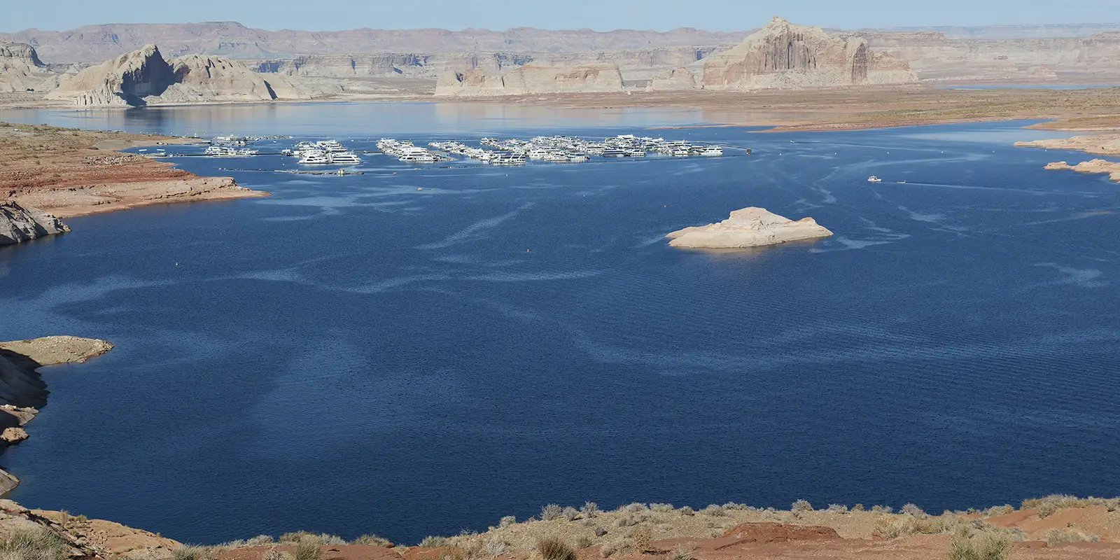
Lake Powell’s iconic Double Arch, a natural Navajo sandstone arch in the Coyote Gulch area of the Escalante River, dating back to 190 million years, collapsed on August 8, 2023. The Double Arch, also known as the Toilet Bowl and the Hole in the Roof, was a popular spot for hikers and photographers. The Double Arch was known for its distinctive twin openings. Hikers and photographers loved this unique stone-scape.
Why Did Utah’s Iconic Double Arch Collapse?
There are several suspected factors that may have contributed to the reason why the Double Arch collapsed at Lake Powell. Frequent foot traffic, natural erosion processes that weakened the arch’s sandstone, waves from Lake Powell, and falling water levels because of the western U.S. drought that began in 2021.
Tyler Knudsen is a Senior Geologist with the Utah Geological Survey’s Geologic Hazards Program in Cedar City. Mr. Knudsen explained the relatively more recent and frequent sandstone rock falls in Glen Canyon National Recreation Area and the Colorado Plateau have to do with the shrinking of the Colorado River affecting water levels at Lake Powell in Utah and Lake Mead in Nevada.
Rock falls are common in regions where large and huge sandstone structures lie atop of their softer shale foundations. Also, ubiquitous small rock falls leave dusty, sandy clutter all over this vast U.S. desert region. Throughout the Colorado Plateau, sandstone rock and cliff falls happen and have been happening all along, but they have happened more frequently since the western U.S. drought began in 2001, according to Mr. Knudsen.
Where Is the Toilet Bowl in Lake Powell? (aka “Double Arch” / “Hole in the Roof”)
The Double Arch is in Rock Creek Bay at Lake Powell in the Glen Canyon National Recreation Area in Utah. Rock Creek Bay is the second northernmost arm of Lake Powell, east of Croton Canyon, Lake Powell’s northernmost arm. Another frequently queried search term is: “Where is Double Arch Lake Powell?” The Toilet Bowl and the Double Arch were the same landmark.
Did Rainbow Bridge Arch Collapse?
Rainbow Arch resided in the Arches National Park in east central Utah. It spanned 117 feet. Nationalarches.org reported in May 2018 that a park ranger saw that Rainbow Arch was no longer when taking a hike in February 2018.
Jeff Moore and Paul Geimer, part of a research team from the University of Utah, took vibration measurements of Rainbow Bridge four times in 2017. The team focused on a significant crack running through the center of the arch that potentially spelled danger for the structure.
When they found no changes in vibrations or in the crack, they suspended their monitoring program. The team did not record Rainbow Bridge’s last few months and weeks, so they did not identify accumulating damage to its structure.
What Is The Colorado Plateau?
It depends on what entity you source. The Colorado Plateau has been defined in various ways by different agencies and organizations. According to the EPA, the Colorado Plateau Level III Ecoregion is mainly the southeastern portion of Utah and southwestern portions of Colorado, with small areas of northern Arizona and northwestern New Mexico.
The U.S. Forest Service designates the Colorado Plateau as a Semidesert Province, mostly in northern Arizona and northwestern New Mexico with relatively small areas of Utah and southwestern portions of Colorado. The Colorado Plateau Native Plant Program (CPNPP) incorporates those two definitions.
The CPNPP includes the Colorado Plateaus and the Arizona/New Mexico Plateau EPA Level III Ecoregions. It cites that “The Colorado Plateau is centered on the four corners area of the Southwest, and includes much of Arizona, Utah, Colorado, and New Mexico.”
What Does the Colorado Plateau Look Like?
John Wesley Powell, former Director of the United States Geological Survey, named and defined the Colorado Plateau. The National Park Service (NPS) characterizes the Colorado Plateau as:
“…a series of tablelands (plateaus or mesas) located within an immense basin surrounded by highlands. Stream valleys that are typically narrow and widely spaced dissect the region, as do larger valleys, including the most spectacular – the Grand Canyon.”
National Park Service
Tens to hundreds of million years ago, mainly sedimentary rocks commonly formed with limestones, sandstones, and shales. Wind and water combined with the rocks and sculpted fantastic rock structures. Where volcanic activity occurred within the Colorado Plateau, volcanic rocks lay strewn across those areas. The terrain of the Colorado Plateau’s canyon bottoms is different from the rest of the Plateau.
Erosion played a role in designing iconic landmarks we see there today, where wind and water have carved out the shapes of the rock formations. The Quaternary age is the current geologic era, which began 2.58 million years ago and continues to the present, and is divided into two epochs: the Pleistocene and the Holocene.
A variety of Quaternary age deposits occurs throughout the Colorado Plateau and is the most recent geologic strata on earth. These deposits include stream channel and floodplain deposits, beach sands, talus gravels, and glacial drift and moraine mass wasting, stream and soil development, and wind erosion. These eroding processes are responsible for Quaternary age deposits, especially along river bottoms and on broad, flat upland areas in the Colorado Plateau.


